Craigieburn Valley Ski Area Trail Map
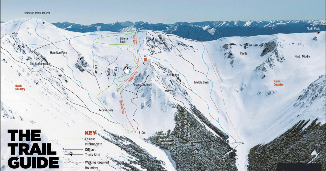
Craigieburn Valley Ski Area is situated on the northwestern end of the Craigieburn Range. Two large basins are accessed by three high capacity rope tows. Craigieburn Valley’s terrain is varied and exciting with challenging steeps and quality snowfall. Storms that are on an easterly storm track typically drop the most powder.
The resort caters to skiers and snowboarders who prefer un-groomed, off-piste terrain. There are multiple options for experienced skiers and riders at Craigieburn. Middle Basin is notorious for its 600m vertical drop that ends at the access road. Hamilton Peak can be accessed via a short hike from the Top Tow lift. Try and find a member of the ski club to show you around as there are many runs that have names that are not displayed on the trail map.
Craigieburn is internationally famous for its many backcountry access points and ski-touring opportunities. Short trips include the Castle Area, North Middle Basin and Mt. Manson.